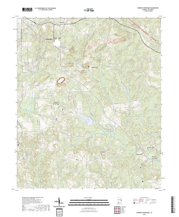
2024 Map of Parkers Crossroads
USGS Topo · Published 2024About this map
Chewacla Creek and its southern tributaries define the topography of this Lee County landscape, where the southern reaches of Opelika transition into a rural network of small communities and family burial grounds. The map documents a cluster of settlements including Parkers Crossroads, Hopewell, and Meadows Crossroads, each connected by a dense web of secondary roads. Water management is a central feature of the terrain, visible in the sequence of reservoirs such as Samford Lake Number One, Samford Lake Number Two, and the Lee County Public Lake. For genealogists, the map is particularly valuable for its documentation of family and community landmarks, from the Penn-Yonge Gravesite near Spring Villa to the Macedonia Primitive Baptist Church Cem. The presence of Griffen Mill and Meadows Mill along Little Uchee Creek indicates a historic reliance on these watercourses for local industry.
Find a feature on this map
119 named features on this map. Tap any name to fly to it.
Don’t see what you’re looking for? This feature index may not catch every label — zoom into the map to look around manually.
Map Details
Editions of this 2024 Parkers Crossroads Map
This is the sole edition of this map. No revisions or reprints were ever made.
Other maps of this area

1907 · Opelika
USGS Topo · 1:125,000

1909 · Opelika
USGS Topo · 1:125,000

1914 · Seale
USGS Topo · 1:62,500

1950 · Crawford
USGS Topo · 1:24,000

1950 · Seale
USGS Topo · 1:62,500

1955 · Crawford
USGS Topo · 1:24,000

1955 · Seale
USGS Topo · 1:62,500

1955 · Phenix City
USGS Topo · 1:250,000

1957 · Phenix City
USGS Topo · 1:250,000

1958 · Phenix City
USGS Topo · 1:250,000