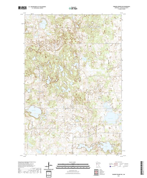
2022 Map of Parkers Prairie NW
USGS Topo · Published 2022About this map
The glacial landscape of northwest Parkers Prairie is defined by a dense concentration of kettle lakes and wetlands, typical of the Otter Tail County lake country. This 2022 survey documents a rural environment where land use is dictated by these water bodies, including the substantial Nelson Lake, Fish Lake, and Lake Sixteen. For genealogists and local historians, the presence of the Folden Cem and the Zion North Effington Cem provides specific points of interest for family research in this township-and-range grid. The road network, including the diagonal Snow Lake Rd and Norwegian Rd, suggests historical routes that preceded the modern section-line roads like Co Hwy 65. Small, scattered water bodies such as Perch Lake and Mud Lake further illustrate the fragmented terrain that has historically shaped farming and development patterns in this portion of central Minnesota.
Find a feature on this map
51 named features on this map. Tap any name to fly to it.
Don’t see what you’re looking for? This feature index may not catch every label — zoom into the map to look around manually.
Map Details
Editions of this 2022 Parkers Prairie NW Map
This is the sole edition of this map. No revisions or reprints were ever made.
Other maps of this area

1912 · Battle Lake
USGS Topo · 1:62,500

1914 · Battle Lake
USGS Topo · 1:62,500

1953 · Brainerd
USGS Topo · 1:250,000

1957 · Brainerd
USGS Topo · 1:250,000

1958 · Brainerd
USGS Topo · 1:250,000

1965 · Brainerd
USGS Topo · 1:250,000
1969 · Lake Miltona West
USGS Topo · 1:24,000
1969 · Lake Miltona East
USGS Topo · 1:24,000

1969 · Henning
USGS Topo · 1:24,000
1969 · Parkers Prairie NW
USGS Topo · 1:24,000
Featured Places
- Effington Township, MN
- Elmo Township, MN
- Folden Township, MN
- Parkers Prairie Township, MN
- Otter Tail County, MN