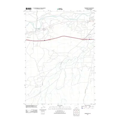
2012 Map of Parkerton
USGS Topo · Published 2012About this map
Big Muddy Oil Field and the winding course of the N Platte River define this portion of Converse County. The map details the transition from the river valley's industrial and residential hubs at Glen Rock and Parkerton into the drainage basins of the south. High-energy energy infrastructure is balanced by a complex network of creeks, including Little Deer Cr, Indian Cr, and Willow Cr, which carve through the high plains. Cultural and historical routes such as Mormon Canyon Rd and True Ranch Rd provide access to the interior, reflecting a landscape shaped by both natural waterways and the extraction economy. Local movement is tied to thoroughfares like Big Muddy Rd and Stephens Rd, which navigate the terrain between established settlements and the sprawling oil operations.
Find a feature on this map
19 named features on this map. Tap any name to fly to it.
Don’t see what you’re looking for? This feature index may not catch every label — zoom into the map to look around manually.
Map Details
Editions of this 2012 Parkerton Map
This is the sole edition of this map. No revisions or reprints were ever made.
Other maps of this area

1949 · Campbell Hill
USGS Topo · 1:24,000

1949 · Parkerton
USGS Topo · 1:24,000

1949 · Glenrock
USGS Topo · 1:24,000

1949 · Glenrock NW
USGS Topo · 1:24,000

1949 · Hylton Ranch
USGS Topo · 1:24,000

1950 · Campbell Hill
USGS Topo · 1:24,000

1950 · Lockett
USGS Topo · 1:24,000

1950 · Parkerton
USGS Topo · 1:24,000

1950 · Glenrock NW
USGS Topo · 1:24,000

1950 · Glenrock
USGS Topo · 1:24,000