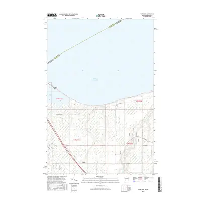
2015 Map of Parkland
USGS Topo · Published 2015About this map
Wisconsin Point extends dramatically into Lake Superior, sheltering the waters of Allouez Bay in this coastal landscape southeast of Superior. The terrain is defined by the drainage networks of the Amnicon River, Dutchman Cr, and Morrison Cr, which carve through the lowland before reaching the lake shore. Small settlements like Parkland and Cutter are situated inland, connected by a network of rural routes including E State Rd 13 and Co Rd Z.
Find a feature on this map
41 named features on this map. Tap any name to fly to it.
Don’t see what you’re looking for? This feature index may not catch every label — zoom into the map to look around manually.
Map Details
Editions of this 2015 Parkland Map
This is the sole edition of this map. No revisions or reprints were ever made.
Other maps of this area

1895 · Duluth
USGS Topo · 1:62,500

1915 · Superior
USGS Topo · 1:48,000

1917 · Superior
USGS Topo · 1:62,500

1949 · Poplar
USGS Topo · 1:48,000

1953 · Lakewood
USGS Topo · 1:24,000

1953 · Duluth
USGS Topo · 1:24,000

1953 · Duluth
USGS Topo · 1:62,500

1953 · Ashland
USGS Topo · 1:250,000

1953 · Duluth
USGS Topo · 1:250,000

1954 · Sunnyside
USGS Topo · 1:24,000