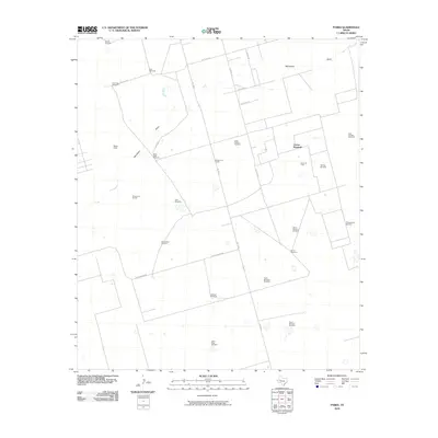
2010 Map of Parks
USGS Topo · Published 2010About this map
Monahans Draw winds through this expanse of the Permian Basin, defining the natural drainage of a landscape primarily shaped by the energy industry and cattle ranching. The presence of the Parks Oil Field and the airstrip at Bates Field indicates a territory managed for resource extraction and logistical support. The map is notably dense with named water sources essential for desert survival and livestock, many bearing the names of local figures and families. Features such as Hi Estes Windmill, South Estes Windmill, and Chuck Houston Windmill offer specific points of interest for genealogists tracing family landholdings in Midland County. The road network, including FM 1788 S and Dora Roberts Rd, connects these isolated outposts, while distinctive landmarks like the Boxcar Windmill and Windmill on the Hill serve as navigational anchors in the flat terrain.
Find a feature on this map
32 named features on this map. Tap any name to fly to it.
Don’t see what you’re looking for? This feature index may not catch every label — zoom into the map to look around manually.
Map Details
Editions of this 2010 Parks Map
This is the sole edition of this map. No revisions or reprints were ever made.
Other maps of this area

1954 · Pecos
USGS Topo · 1:250,000

1957 · Pecos
USGS Topo · 1:250,000

1964 · Bryant Ranch
USGS Topo · 1:24,000

1964 · Odessa NE
USGS Topo · 1:24,000

1964 · Odessa SE
USGS Topo · 1:24,000

1964 · Parks
USGS Topo · 1:24,000

1965 · Southeast Midland
USGS Topo · 1:24,000

1965 · Southwest Midland
USGS Topo · 1:24,000

1965 · South Cowden Ranch
USGS Topo · 1:24,000

1968 · Benge Corner NW
USGS Topo · 1:24,000