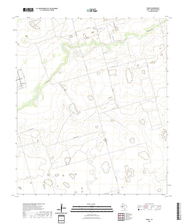
2022 Map of Parks
USGS Topo · Published 2022About this map
Monahans Draw meanders across the northern portion of this Midland County landscape, providing a rare hydrographic landmark in a region defined by its wide, open terrain. This 2022 survey illustrates the modern layout of rural infrastructure, where long, straight county roads like W Co Rd 170 and W Co Rd 181 intersect with major thoroughfares such as Ranch Rd 1788. The map documents large-scale landholdings like the Scharbauer Ranch, highlighting the enduring legacy of ranching in West Texas even as modern developments like Bates Field appear on the horizon. Geographers and local historians can trace the network of secondary routes, including Dora Roberts Rd, which provide access to the vast ranch lands and industrial sites that characterize the Permian Basin today.
Find a feature on this map
20 named features on this map. Tap any name to fly to it.
Don’t see what you’re looking for? This feature index may not catch every label — zoom into the map to look around manually.
Map Details
Editions of this 2022 Parks Map
This is the sole edition of this map. No revisions or reprints were ever made.
Other maps of this area

1954 · Pecos
USGS Topo · 1:250,000

1957 · Pecos
USGS Topo · 1:250,000

1964 · Bryant Ranch
USGS Topo · 1:24,000

1964 · Odessa NE
USGS Topo · 1:24,000

1964 · Odessa SE
USGS Topo · 1:24,000

1964 · Parks
USGS Topo · 1:24,000

1965 · Southeast Midland
USGS Topo · 1:24,000

1965 · Southwest Midland
USGS Topo · 1:24,000

1965 · South Cowden Ranch
USGS Topo · 1:24,000

1968 · Benge Corner NW
USGS Topo · 1:24,000