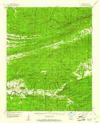
1960 Map of Parks
USGS Topo · Published 1961About this map
Ouachita National Forest dominates this topographic view of Scott County, where ridges like Bee Mountain and Ouachita Mountain run parallel through the timbered landscape. The settlement of Parks serves as a small hub near the confluence of local streams, while the village of Ballard sits tucked into the northern valley near Mt Pleasant Ch. This era shows a community structured around its small rural institutions, including the Dutch Creek Sch and several country cemeteries such as Hunt Cem and Jameson Cem. The river systems here are the defining geographic features, with the Petit Jean River and La Fave River carving through the heavy terrain. Strategic high points are marked by a network of fire detection infrastructure, including the Bear Knob Lookout Tower, White Oak Lookout Tower, and Abbot Lookout Tower, which provided oversight for the surrounding forest service lands.
Find a feature on this map
123 named features on this map. Tap any name to fly to it.
Don’t see what you’re looking for? This feature index may not catch every label — zoom into the map to look around manually.
Map Details
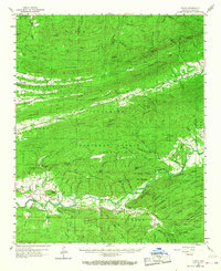
Editions of this 1960 Parks Map
2 editions found
Other maps of this area

1879 · Poteau Mountain
USGS Topo · 1:62,500

1879 · Mountain Home
USGS Topo · 1:62,500

1887 · Poteau Mountain #1
USGS Topo · 1:62,500

1887 · Magazine Mountain #4
USGS Topo · 1:62,500

1887 · Mount Ida #2
USGS Topo · 1:62,500

1887 · Magazine Mountain #3
USGS Topo · 1:62,500

1887 · Magazine Mountain
USGS Topo · 1:62,500

1890 · Magazine Mountain
USGS Topo · 1:125,000

1890 · Mount Ida
USGS Topo · 1:125,000

1890 · Fort Smith
USGS Topo · 1:125,000