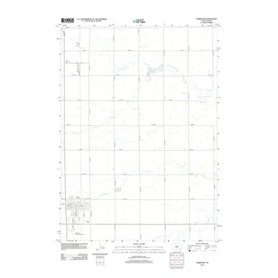
2012 Map of Parkston
USGS Topo · Published 2012About this map
The agricultural landscape surrounding Parkston is defined by a grid of section-line roads and the winding paths of several prairie waterways. Tributaries like S Fork Twelvemile Cr and Pony Cr cut through the South Dakota plains, with the former expanding into Lake Dimock in the northeastern portion of the sheet. This 2012 survey illustrates the organized layout of the town, centered on a dense street network featuring W Main St and S Main St. Several religious and community landmarks are documented, including Saint Peters Cem north of town and Sacred Heart Cem to the south. Local infrastructure is further anchored by the Parkston Municipal Airport, situated at the southern edge of the settled area near Airport Rd.
Find a feature on this map
39 named features on this map. Tap any name to fly to it.
Don’t see what you’re looking for? This feature index may not catch every label — zoom into the map to look around manually.
Map Details
Editions of this 2012 Parkston Map
This is the sole edition of this map. No revisions or reprints were ever made.
Other maps of this area

1898 · Olivet
USGS Topo · 1:125,000

1899 · Mitchell
USGS Topo · 1:125,000

1899 · Alexandria
USGS Topo · 1:125,000

1955 · Sioux Falls
USGS Topo · 1:250,000

1955 · Mitchell
USGS Topo · 1:250,000

1957 · Ethan
USGS Topo · 1:24,000

1957 · Milltown
USGS Topo · 1:24,000

1957 · Rockport Colony
USGS Topo · 1:24,000

1958 · Sioux Falls
USGS Topo · 1:250,000

1959 · Mitchell
USGS Topo · 1:250,000