
2021 Map of Parkston
USGS Topo · Published 2021About this map
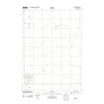
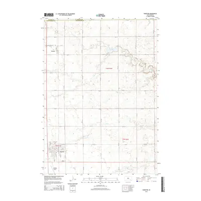
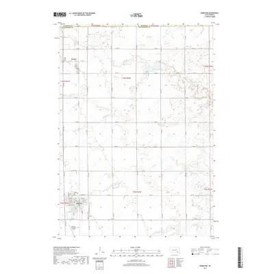
Parkston and Dimock anchor this rural landscape in southeastern South Dakota, reflecting a classic Midwestern grid of section roads and small-town development. The map details the local hydrology of the James River basin, where meandering waterways like S Fork Twelvemile Cr, Pony Cr, and Coffee Cr cut through the agricultural sections. In Parkston, the street plan is fully articulated with thoroughfares such as W Main St and E Maple St, extending south toward the Parkston Municipal Airport. Genealogists will find particular value in the clearly marked burial grounds serving these communities, including Sacred Heart Cem and Parkston Cem near the town center, and Saint Peters Cem located to the northwest near Dimock. The layout of these settlements against the expansive township and range lines reveals the enduring structure of the region's land use.
Find a feature on this map
40 named features on this map. Tap any name to fly to it.
Don’t see what you’re looking for? This feature index may not catch every label — zoom into the map to look around manually.
Map Details
Editions of this 2021 Parkston Map
This is the sole edition of this map. No revisions or reprints were ever made.
Historical Maps of Parkston Through Time
5 maps found
Featured Locations
- Worthen Township, SD
- Starr Township, SD
- Cross Plains Township, SD
- Parkston, Liberty Township
- Dimock, Cross Plains Township