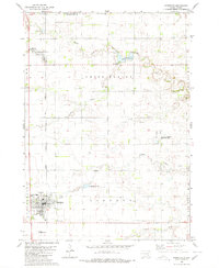
1980 Map of Parkston
USGS Topo · Published 1980About this map
Parkston and Dimock anchor this South Dakota landscape, where the Chicago Milwaukee St Paul and Pacific railroad forms a primary north-south axis through the central plains. This 1980 edition reveals a well-established rural infrastructure defined by several significant ecclesiastical and community landmarks. Genealogists will note the detailed placement of SS Peter & Paul Cem near Dimock, alongside the Sacred Heart Cem and Parkston Cem situated further south.
Find a feature on this map
29 named features on this map. Tap any name to fly to it.
Don’t see what you’re looking for? This feature index may not catch every label — zoom into the map to look around manually.
Map Details
Editions of this 1980 Parkston Map
This is the sole edition of this map. No revisions or reprints were ever made.
Other maps of this area

1898 · Olivet
USGS Topo · 1:125,000

1899 · Mitchell
USGS Topo · 1:125,000

1899 · Alexandria
USGS Topo · 1:125,000

1955 · Sioux Falls
USGS Topo · 1:250,000

1955 · Mitchell
USGS Topo · 1:250,000

1957 · Ethan
USGS Topo · 1:24,000

1957 · Milltown
USGS Topo · 1:24,000

1957 · Rockport Colony
USGS Topo · 1:24,000

1958 · Sioux Falls
USGS Topo · 1:250,000

1959 · Mitchell
USGS Topo · 1:250,000