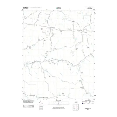
2010 Map of Parksville
USGS Topo · Published 2010About this map
Mitchellsburg and Parksville anchor this 2010 survey of Boyle County, where the topography transitions from the northern river valleys to the high ridges of the south. The landscape is defined by the winding North Rolling Fork and numerous family-named hollows and ridges, such as Peach Orchard Ridge and Whites Ridge. This map is particularly valuable for genealogists, as it preserves the locations of over a dozen small burial grounds, including the Purdom Cemetery, Roller Cemetery, and Southerland Cemetery near the Little South Fork. To the south, the terrain becomes more distinct with features like Sherman Knob and Parksville Knob, while the small settlement of Butchertown sits at the edge of the Big Hollow. The intricate network of local roads, such as Baugh Hollow Rd and Tennessee Ridge Rd, reflects a history of small-scale agricultural and rural residential development along the valley floors.
Find a feature on this map
90 named features on this map. Tap any name to fly to it.
Don’t see what you’re looking for? This feature index may not catch every label — zoom into the map to look around manually.
Map Details
Editions of this 2010 Parksville Map
This is the sole edition of this map. No revisions or reprints were ever made.
Other maps of this area

1905 · Harrodsburg
USGS Topo · 1:125,000

1952 · Perryville
USGS Topo · 1:24,000

1952 · Ellisburg
USGS Topo · 1:24,000

1952 · Hustonville
USGS Topo · 1:24,000

1952 · Danville
USGS Topo · 1:24,000

1952 · Junction City
USGS Topo · 1:24,000

1952 · Parksville
USGS Topo · 1:24,000

1953 · Mackville
USGS Topo · 1:24,000

1953 · Bradfordsville NE
USGS Topo · 1:24,000

1953 · Gravel Switch
USGS Topo · 1:24,000