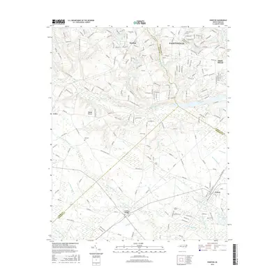
2016 Map of Parkton
USGS Topo · Published 2016About this map
Parkton and Lumber Bridge serve as the primary hubs in this coastal plain landscape where the borders of Cumberland, Hoke, and Robeson counties converge. The terrain is defined by a dense network of blackwater drainage systems, including the expansive Little Marsh Swamp, Bogue Swamp, and Big Marsh Swamp, which weave between small settlements and agricultural fields. This 2016 survey documents the suburban expansion south of Fayetteville near Hope Mills, contrasted with the enduring rural character of communities like Sandy Grove and Arabia. Local heritage is anchored by sites such as Wood Cem and McGougan Cem, while the regional hydrology is marked by numerous millponds and reservoirs, including Upchurches Pond and Barbours Lake. Aviation and local transport are represented by E T Field and a network of named country roads that trace the sandy ridges between the low-lying wetlands.
Find a feature on this map
188 named features on this map. Tap any name to fly to it.
Don’t see what you’re looking for? This feature index may not catch every label — zoom into the map to look around manually.
Map Details
Editions of this 2016 Parkton Map
This is the sole edition of this map. No revisions or reprints were ever made.
Other maps of this area

1948 · Fayetteville
USGS Topo · 1:62,500

1948 · Clifdale
USGS Topo · 1:62,500

1948 · Nicholson Creek
USGS Topo · 1:24,000

1948 · Clifdale
USGS Topo · 1:24,000

1950 · Clifdale
USGS Topo · 1:24,000

1950 · Fayetteville
USGS Topo · 1:24,000

1950 · Nicholson Creek
USGS Topo · 1:24,000

1951 · Clifdale
USGS Topo · 1:62,500

1953 · Florence
USGS Topo · 1:250,000

1953 · Raleigh
USGS Topo · 1:250,000