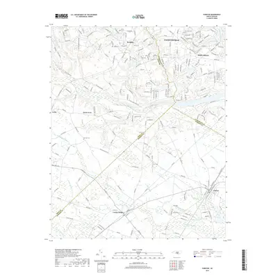
2019 Map of Parkton
USGS Topo · Published 2019About this map
Lumber Bridge and Parkton anchor the southern reaches of this landscape, where the agricultural plains of the inner coastal plain meet an intricate network of wetlands. This territory is defined by its drainage patterns, with Little Marsh Swamp and Bogue Swamp threading through the countryside between small rural communities like Arabia and Sandy Grove. The area serves as a significant jurisdictional crossroads, where the borders of Cumberland, Hoke, and Robeson counties converge amidst a patchwork of farms and wooded tracts.
Find a feature on this map
203 named features on this map. Tap any name to fly to it.
Don’t see what you’re looking for? This feature index may not catch every label — zoom into the map to look around manually.
Map Details
Editions of this 2019 Parkton Map
This is the sole edition of this map. No revisions or reprints were ever made.
Other maps of this area

1948 · Fayetteville
USGS Topo · 1:62,500

1948 · Clifdale
USGS Topo · 1:62,500

1948 · Nicholson Creek
USGS Topo · 1:24,000

1948 · Clifdale
USGS Topo · 1:24,000

1950 · Clifdale
USGS Topo · 1:24,000

1950 · Fayetteville
USGS Topo · 1:24,000

1950 · Nicholson Creek
USGS Topo · 1:24,000

1951 · Clifdale
USGS Topo · 1:62,500

1953 · Florence
USGS Topo · 1:250,000

1953 · Raleigh
USGS Topo · 1:250,000