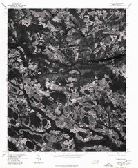
1976 Map of Parkton
USGS Topo · Published 1978About this map
Parkton serves as a primary settlement point in this mid-1970s orthophotograph, showcasing the agricultural and wooded landscape of Robeson County. The imagery, captured in early 1976, reveals the intricate patterns of field boundaries and drainage across the coastal plain. To the west, the town of Lumber Bridge sits amidst a network of rural roads and clearing, while Rockfish anchors the northern portion of the quadrangle. This specialized photo-map provides a literal view of land use during the era, highlighting the transition between dense timber stands and cultivated acreage that defined the local economy and settlement patterns before modern suburban expansion. Genealogists and historians can use these clear aerial views to identify specific farmsteads and the exact footprint of rural communities in the Bicentennial year.
Find a feature on this map
3 named features on this map. Tap any name to fly to it.
Don’t see what you’re looking for? This feature index may not catch every label — zoom into the map to look around manually.
Map Details
Editions of this 1976 Parkton Map
This is the sole edition of this map. No revisions or reprints were ever made.
Other maps of this area

1948 · Fayetteville
USGS Topo · 1:62,500

1948 · Clifdale
USGS Topo · 1:62,500

1948 · Nicholson Creek
USGS Topo · 1:24,000

1948 · Clifdale
USGS Topo · 1:24,000

1950 · Clifdale
USGS Topo · 1:24,000

1950 · Fayetteville
USGS Topo · 1:24,000

1950 · Nicholson Creek
USGS Topo · 1:24,000

1951 · Clifdale
USGS Topo · 1:62,500

1953 · Florence
USGS Topo · 1:250,000

1953 · Raleigh
USGS Topo · 1:250,000