2010 Map of Parmerton
USGS Topo · Published 2010About this map
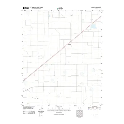
Parmerton sits at the intersection of a major diagonal railway and a strictly organized section-line road grid in this 2010 survey of Parmer County. This landscape is defined by the ephemeral hydrology of the Llano Estacado, where the subtle depressions of Frio Draw, Catfish Draw, and Running Water Draw snake across the high plains. Unlike the rigid geometry of the county roads such as Co Rd J and Co Rd N, these natural draws follow the ancient, meandering drainage patterns of the region. The map reveals the immense scale of West Texas agricultural division, where names like Garza Rd and numerous numbered county routes provide the only landmarks across a territory shaped by ranching and industrial-scale farming. The concentration of structures remains sparse, centered primarily around the rail line and key crossroads.
Find a feature on this map
19 named features on this map. Tap any name to fly to it.
Don’t see what you’re looking for? This feature index may not catch every label — zoom into the map to look around manually.
Map Details
Editions of this 2010 Parmerton Map
This is the sole edition of this map. No revisions or reprints were ever made.
Other maps of this area

1954 · Clovis
USGS Topo · 1:250,000

1958 · Clovis
USGS Topo · 1:250,000

1963 · Clays Corner
USGS Topo · 1:24,000

1963 · Oklahoma Lane
USGS Topo · 1:24,000

1963 · Lariat NE
USGS Topo · 1:24,000

1965 · Bovina
USGS Topo · 1:24,000

1965 · Parmerton
USGS Topo · 1:24,000

1965 · Hub
USGS Topo · 1:24,000

1965 · Twin Lakes
USGS Topo · 1:24,000

1965 · Rhea
USGS Topo · 1:24,000