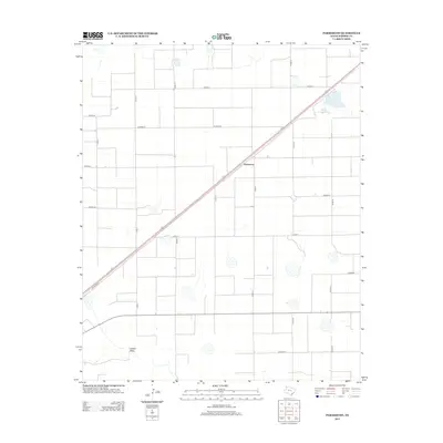
2012 Map of Parmerton
USGS Topo · Published 2012About this map
Parmerton sits at the center of this High Plains landscape in Parmer County, defined by a rigid grid of agricultural section lines and a prominent rail corridor. The settlement's proximity to the southwest-to-northeast transportation artery is underscored by the presence of Railroad Rd, which runs parallel to the tracks. The terrain is characterized by numerous seasonal depressions and playas typical of the Panhandle, with Catfish Draw providing the primary hydrographic relief in the southern portion of the quadrangle. A systematic network of county roads, including Co Road J and Co Road K, facilitates access across the vast ranching and farming tracts. This 2012 survey illustrates the persistent importance of the railroad in shaping the development and orientation of small Panhandle communities like Parmerton.
Find a feature on this map
18 named features on this map. Tap any name to fly to it.
Don’t see what you’re looking for? This feature index may not catch every label — zoom into the map to look around manually.
Map Details
Editions of this 2012 Parmerton Map
This is the sole edition of this map. No revisions or reprints were ever made.
Other maps of this area

1954 · Clovis
USGS Topo · 1:250,000

1958 · Clovis
USGS Topo · 1:250,000

1963 · Clays Corner
USGS Topo · 1:24,000

1963 · Oklahoma Lane
USGS Topo · 1:24,000

1963 · Lariat NE
USGS Topo · 1:24,000

1965 · Bovina
USGS Topo · 1:24,000

1965 · Parmerton
USGS Topo · 1:24,000

1965 · Hub
USGS Topo · 1:24,000

1965 · Twin Lakes
USGS Topo · 1:24,000

1965 · Rhea
USGS Topo · 1:24,000