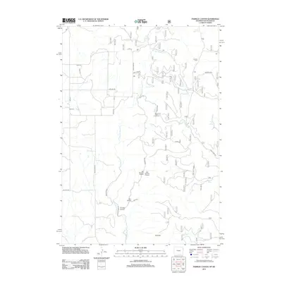
2012 Map of Parmlee Canyon
USGS Topo · Published 2012About this map
Parmlee Canyon and its associated drainages define this high-country landscape along the South Dakota and Wyoming border. The terrain is characterized by a complex network of canyons and springs, including Wet Parmlee Canyon, Dry Parmlee Canyon, and the appropriately named State Line Spring. This 2012 survey illustrates a land primarily used for ranching and recreation, with Cool Pasture and several corrals like Sanders Corral marking the agricultural footprint. Water sources are critical here, with named features such as Slicker Dick Spring and Austin Spring feeding into Stockade Beaver Cr. The Boyd Cem and the Beaver Creek Campground provide focal points for local history and public land use, while the southern portion rises into the Bald Hills.
Find a feature on this map
34 named features on this map. Tap any name to fly to it.
Don’t see what you’re looking for? This feature index may not catch every label — zoom into the map to look around manually.
Map Details
Editions of this 2012 Parmlee Canyon Map
This is the sole edition of this map. No revisions or reprints were ever made.
Other maps of this area

1894 · Deadwood
USGS Topo · 1:125,000

1896 · Harney Peak
USGS Topo · 1:125,000

1898 · Sundance
USGS Topo · 1:125,000

1899 · Newcastle
USGS Topo · 1:125,000

1901 · Harney Peak
USGS Topo · 1:125,000

1901 · Deadwood
USGS Topo · 1:125,000

1901 · Newcastle
USGS Topo · 1:125,000

1902 · Sundance
USGS Topo · 1:125,000

1916 · Deadwood
USGS Topo · 1:125,000

1953 · Rapid City
USGS Topo · 1:250,000