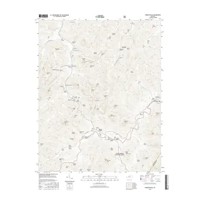
2016 Map of Parmleysville
USGS Topo · Published 2016About this map
Parmleysville and the surrounding plateau of southern Wayne County appear here in a landscape defined by deep drainages and family legacies. The Little S Fork and Beaver Cr have carved numerous hollows, such as Criswell Hollow and Stillhouse Hollow, creating a complex topography of ridges like Ball Ridge and prominent sandstone features including Coopers Cliff and Rattlesnake Cliff. These natural barriers dictated the settlement patterns of the 21st century, where small communities like Burfield and Mount Pisgah remain connected by winding routes such as Patton Creek Rd. The map is particularly notable for its density of family burial sites, including the Lewis Coffey Family Cem, Hucaby-Eaton Cem, and Gregory-Corder Cem, which offer significant value for genealogical research. Much of the southern portion of the area is protected as part of the Daniel Boone National Forest.
Find a feature on this map
105 named features on this map. Tap any name to fly to it.
Don’t see what you’re looking for? This feature index may not catch every label — zoom into the map to look around manually.
Map Details
Editions of this 2016 Parmleysville Map
This is the sole edition of this map. No revisions or reprints were ever made.
Other maps of this area

1911 · Monticello
USGS Topo · 1:62,500

1914 · Monticello
USGS Topo · 1:62,500

1932 · Burnside
USGS Topo · 1:62,500

1934 · Barthell
USGS Topo · 1:62,500

1934 · Pall Mall
USGS Topo · 1:62,500

1953 · Parnell
USGS Topo · 1:24,000

1953 · Monticello
USGS Topo · 1:24,000

1954 · Parmleysville
USGS Topo · 1:24,000

1954 · Coopersville
USGS Topo · 1:24,000

1954 · Powersburg
USGS Topo · 1:24,000