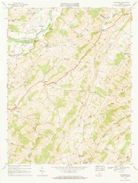
1967 Map of Parnassus
USGS Topo · Published 1968About this map
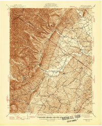
Natural Chimneys stand as a prominent geological landmark along the North Fork River, anchoring this mid-1960s landscape of rural Augusta County. The area is defined by a dense network of winding watercourses, including Moffett Creek, Mossy Creek, and Long Glade, which shaped the early settlement patterns and agricultural development of the region. Distinctive communities like Mt Solon, Parnassus, and Spring Hill are documented with their local institutions, from the North River Jr High Sch to St Pauls Ch.
Find a feature on this map
34 named features on this map. Tap any name to fly to it.
Don’t see what you’re looking for? This feature index may not catch every label — zoom into the map to look around manually.
Map Details
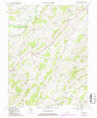
Editions of this 1967 Parnassus Map
2 editions found
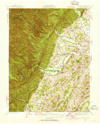
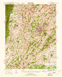
Other maps of this area

1892 · Harrisonburg
USGS Topo · 1:125,000

1894 · Staunton
USGS Topo · 1:125,000

1934 · Waynesboro
USGS Topo · 1:48,000

1939 · Waynesboro
USGS Topo · 1:62,500

1941 · Harrisonburg
USGS Topo · 1:62,500

1943 · Harrisonburg
USGS Topo · 1:62,500
1944 · Parnassus
USGS Topo · 1:62,500
1944 · Staunton
USGS Topo · 1:62,500

1947 · Staunton
USGS Topo · 1:62,500
1947 · Parnassus
USGS Topo · 1:62,500