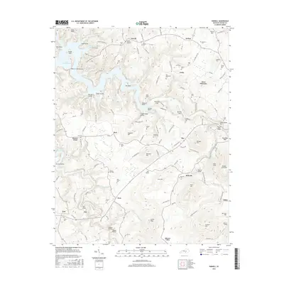
2016 Map of Parnell
USGS Topo · Published 2016About this map
Lake Cumberland and its winding inlets, such as the Beaver Creek Narrows, dominate the northwestern portion of this Wayne County landscape. The topography is defined by a dense network of hollows and ridges, where small communities like Parnell, Slat, and Bethesda are linked by winding roads that follow the natural contours of the land. The distribution of family-named cemeteries, including the Bradshaw Cem, Alley Cem, and George Morris Cem, indicates a deeply rooted rural settlement pattern. Significant elevations like Magallon Mtn and Pilot Mtn rise above the valleys, while features such as the Zula Bridge over Otter Creek highlight the critical local crossings. The southern extent reveals numerous springs and branches feeding into larger waterways, such as Simpson Br and Brammer Br, which have shaped the agricultural and domestic life of the region for generations.
Find a feature on this map
136 named features on this map. Tap any name to fly to it.
Don’t see what you’re looking for? This feature index may not catch every label — zoom into the map to look around manually.
Map Details
Editions of this 2016 Parnell Map
This is the sole edition of this map. No revisions or reprints were ever made.
Other maps of this area

1911 · Monticello
USGS Topo · 1:62,500

1914 · Monticello
USGS Topo · 1:62,500

1929 · Byrdstown
USGS Topo · 1:62,500

1934 · Pall Mall
USGS Topo · 1:62,500

1953 · Parnell
USGS Topo · 1:24,000

1953 · Monticello
USGS Topo · 1:24,000

1953 · Mill Springs
USGS Topo · 1:24,000

1953 · Jamestown
USGS Topo · 1:24,000

1954 · Jabez
USGS Topo · 1:24,000

1954 · Parmleysville
USGS Topo · 1:24,000