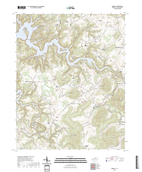
2022 Map of Parnell
USGS Topo · Published 2022About this map
Lake Cumberland dominates this portion of Wayne County, its serpentine fingers reaching into deep valleys like Ramsey Hollow and Claude Phipps Hollow. The landscape is a complex network of ridges and knobs, where family names are etched into the geography at sites such as Twyford Point and Magallon Mtn. The settlement pattern follows the high ground and narrow valley floors, connected by routes like W State Hwy 92 and KY 90.
Find a feature on this map
90 named features on this map. Tap any name to fly to it.
Don’t see what you’re looking for? This feature index may not catch every label — zoom into the map to look around manually.
Map Details
Editions of this 2022 Parnell Map
This is the sole edition of this map. No revisions or reprints were ever made.
Other maps of this area

1911 · Monticello
USGS Topo · 1:62,500

1914 · Monticello
USGS Topo · 1:62,500

1929 · Byrdstown
USGS Topo · 1:62,500

1934 · Pall Mall
USGS Topo · 1:62,500

1953 · Parnell
USGS Topo · 1:24,000

1953 · Monticello
USGS Topo · 1:24,000

1953 · Mill Springs
USGS Topo · 1:24,000

1953 · Jamestown
USGS Topo · 1:24,000

1954 · Jabez
USGS Topo · 1:24,000

1954 · Parmleysville
USGS Topo · 1:24,000