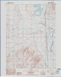
1986 Map of Parran
USGS Topo · Published 1992About this map
The Forty Mile Desert and the arid basin of the Carson Sink dominate this mid-1980s survey of Churchill County. This harsh landscape was a critical corridor for early transcontinental travel, evidenced here by the Southern Pacific railroad line and a Historical Marker situated near the small settlement of Parran. The transition from the Hot Springs Mountains in the south to the White Plains in the north reveals a geography of extremes, where hydrology is defined by seasonal features like Alkali Flat and Humboldt Slough.
Find a feature on this map
26 named features on this map. Tap any name to fly to it.
Don’t see what you’re looking for? This feature index may not catch every label — zoom into the map to look around manually.
Map Details
Editions of this 1986 Parran Map
2 editions found
Other maps of this area

1908 · Carson Sink
USGS Topo · 1:250,000

1910 · Carson Sink
USGS Topo · 1:250,000

1950 · Stillwater
USGS Topo · 1:62,500

1951 · Soda Lake
USGS Topo · 1:62,500

1951 · Carson Sink
USGS Topo · 1:62,500

1951 · Desert Peak
USGS Topo · 1:62,500

1957 · Reno
USGS Topo · 1:250,000

1959 · Reno
USGS Topo · 1:250,000

1960 · Reno
USGS Topo · 1:250,000

1979 · Carson Sink
USGS Topo · 1:100,000