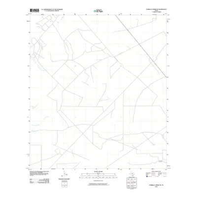
2010 Map of Parrilla Creek NE
USGS Topo · Published 2010About this map
San Isidro Cemetery stands as a focal point for genealogy in this corner of Duval County, where the landscape is defined by the ephemeral drainages of the South Texas brush country. The map traces the converging courses of several seasonal waterways, most notably the winding path of Las Animas Creek as it moves across the central and southern portions of the quadrangle. In the northwest, the terrain is split by Animas Creek North and Animas Creek South, while the western edge reveals the upper reaches of Parrilla Creek and its distinct forks, Parrilla Creek North and Parrilla Creek South. This modern survey by the U.S. Geological Survey shows a sparse road network, with Co Rd 342 serving as one of the primary arteries through a region dominated by large ranch tracts and natural hydrology.
Find a feature on this map
8 named features on this map. Tap any name to fly to it.
Don’t see what you’re looking for? This feature index may not catch every label — zoom into the map to look around manually.
Map Details
Editions of this 2010 Parrilla Creek NE Map
This is the sole edition of this map. No revisions or reprints were ever made.
Other maps of this area

1956 · Benavides
USGS Topo · 1:62,500

1956 · Rosita Ranch
USGS Topo · 1:62,500

1956 · Freer
USGS Topo · 1:62,500

1956 · Laredo
USGS Topo · 1:250,000

1967 · Parrilla Creek SE
USGS Topo · 1:24,000

1968 · Parrilla Creek SW
USGS Topo · 1:24,000

1968 · Benavides NW
USGS Topo · 1:24,000

1968 · Benavides
USGS Topo · 1:24,000

1968 · Parrilla Creek NW
USGS Topo · 1:24,000

1968 · Parrilla Creek NE
USGS Topo · 1:24,000