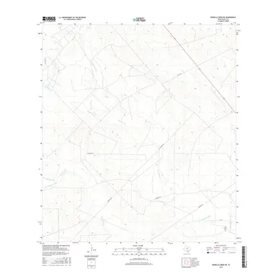
2016 Map of Parrilla Creek NE
USGS Topo · Published 2016About this map
San Isidro Cem stands as a primary point of interest in this section of Duval County, where the landscape is defined by the complex drainage systems of the South Texas brush country. The map tracks the convergence and diverging paths of several seasonal waterways, most notably Parrilla Creek and the bifurcated Parrilla Creek North and Parrilla Creek South. This area is characterized by large private landholdings, connected by a network of ranch roads such as Privranch Rd. The transition from Animas Cr North and Animas Cr South into the broader Las Animas Creek illustrates the intricate natural irrigation and topographic variations that have shaped ranching operations in this region for generations.
Find a feature on this map
12 named features on this map. Tap any name to fly to it.
Don’t see what you’re looking for? This feature index may not catch every label — zoom into the map to look around manually.
Map Details
Editions of this 2016 Parrilla Creek NE Map
This is the sole edition of this map. No revisions or reprints were ever made.
Other maps of this area

1956 · Benavides
USGS Topo · 1:62,500

1956 · Rosita Ranch
USGS Topo · 1:62,500

1956 · Freer
USGS Topo · 1:62,500

1956 · Laredo
USGS Topo · 1:250,000

1967 · Parrilla Creek SE
USGS Topo · 1:24,000

1968 · Parrilla Creek SW
USGS Topo · 1:24,000

1968 · Benavides NW
USGS Topo · 1:24,000

1968 · Benavides
USGS Topo · 1:24,000

1968 · Parrilla Creek NW
USGS Topo · 1:24,000

1968 · Parrilla Creek NE
USGS Topo · 1:24,000