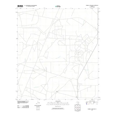
2010 Map of Parrilla Creek NW
USGS Topo · Published 2010About this map
Perez Windmill and New Windmill stand as distinctive landmarks in this corner of Duval County, marking essential water infrastructure in a landscape defined by intermittent drainage and ranching needs. The terrain is structured by the courses of Parrilla Creek North and Parrilla Creek South, which traverse the area alongside Animas Creek South. This 2010 survey illustrates a sparsely populated region where a network of local roads and 4WD tracks connects these isolated points of interest. The presence of named windmills highlights the historical and ongoing importance of groundwater access for land management in this part of South Texas, providing a specific geographic anchor for researchers tracing rural property boundaries and ranching operations.
Find a feature on this map
5 named features on this map. Tap any name to fly to it.
Don’t see what you’re looking for? This feature index may not catch every label — zoom into the map to look around manually.
Map Details
Editions of this 2010 Parrilla Creek NW Map
This is the sole edition of this map. No revisions or reprints were ever made.
Other maps of this area

1956 · Freer
USGS Topo · 1:62,500

1956 · Las Mujeres
USGS Topo · 1:62,500

1956 · Laredo
USGS Topo · 1:250,000

1967 · Parrilla Creek SE
USGS Topo · 1:24,000

1968 · Parrilla Creek SW
USGS Topo · 1:24,000

1968 · Mills Bennett
USGS Topo · 1:24,000

1968 · Parrilla Creek NW
USGS Topo · 1:24,000

1968 · Parrilla Creek NE
USGS Topo · 1:24,000

1968 · San Pablo
USGS Topo · 1:24,000
1971 · Freer South
USGS Topo · 1:24,000