
1950 Map of Parrish
USGS Topo · Published 1956About this map
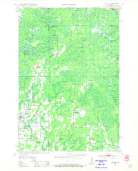
Parrish and the surrounding north woods of Langlade and Lincoln Counties appear as a landscape transitioning from the logging era to a mix of forestry and rural settlement in this 1950 field examination. Evidence of the region's industrial past is etched across the terrain in the form of an Old Railroad Grade that once served the timber camps, while numerous Fire Lanes crisscross the townships of Harrison, Elcho, and Summit. Social centers for the local community are well-documented, including several schools like the Liberty Bell Sch and the Rocky Glen Sch. Notably, the map records the cultural heritage of European immigrants through labels for the Estonian Ch and Lettish Ch near Gleason. High points such as Lookout Mountain Tower and Baldy Hill overlook a dense network of water bodies, including Two Island Lake, Seven Island L, and Lake Clara.
Find a feature on this map
92 named features on this map. Tap any name to fly to it.
Don’t see what you’re looking for? This feature index may not catch every label — zoom into the map to look around manually.
Map Details
Editions of this 1950 Parrish Map
2 editions found
Other maps of this area

1899 · Wausau
USGS Topo · 1:125,000

1902 · Wausau
USGS Topo · 1:125,000

1939 · Cassian
USGS Topo · 1:48,000

1940 · Parrish
USGS Topo · 1:48,000

1940 · Monico
USGS Topo · 1:48,000

1940 · Rhinelander
USGS Topo · 1:48,000

1942 · Cassian
USGS Topo · 1:48,000

1942 · Elcho
USGS Topo · 1:48,000

1949 · Rhinelander
USGS Topo · 1:48,000

1950 · Monico
USGS Topo · 1:48,000