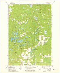
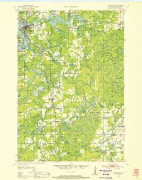
1973 Map of Parrish
USGS Topo · Published 1976About this map
The Harrison Hills dominate this section of Wisconsin, where glacial activity left behind a landscape densely saturated with kettle lakes and moraine features. Settlements are sparse, centered on Parrish and Bandy, reflecting a region primarily dedicated to timber and recreation by the early 1970s. The presence of an Old Railroad Grade running through the Prairie River State Public Hunting and Fishing Area speaks to the area's logging history, while the Lookout Tower atop Lookout Mountain provided a vantage point for forest fire detection across the dense canopy of the Enterprise area.
Find a feature on this map
66 named features on this map. Tap any name to fly to it.
Don’t see what you’re looking for? This feature index may not catch every label — zoom into the map to look around manually.
Map Details
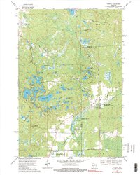
Editions of this 1973 Parrish Map
2 editions found
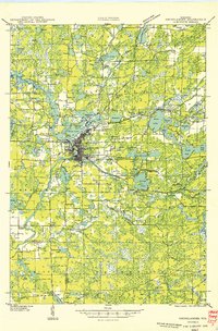
Other maps of this area

1939 · Cassian
USGS Topo · 1:48,000

1940 · Parrish
USGS Topo · 1:48,000

1940 · Rhinelander
USGS Topo · 1:48,000

1942 · Cassian
USGS Topo · 1:48,000
1949 · Rhinelander
USGS Topo · 1:48,000
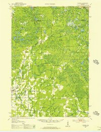
1950 · Parrish
USGS Topo · 1:48,000
1950 · Tomahawk
USGS Topo · 1:48,000

1952 · Parrish
USGS Topo · 1:48,000
1952 · Tomahawk
USGS Topo · 1:48,000

1954 · Iron Mountain
USGS Topo · 1:250,000