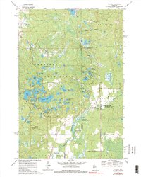
1973 Map of Parrish
USGS Topo · Published 1990About this map
Parrish is the primary settlement on this sheet, situated along the edge of the Harrison Hills near the boundary of Lincoln Co and Langlade County. The landscape is defined by an intricate network of glacial lakes and kettle holes, including large bodies like Seven Island Lake, Turtle Lake, and Pine Lake. The presence of the Old Railroad Grade near the town center indicates the region's historical reliance on timber transport through the dense northwoods.
Find a feature on this map
60 named features on this map. Tap any name to fly to it.
Don’t see what you’re looking for? This feature index may not catch every label — zoom into the map to look around manually.
Map Details
Editions of this 1973 Parrish Map
2 editions found
Other maps of this area

1939 · Cassian
USGS Topo · 1:48,000

1940 · Parrish
USGS Topo · 1:48,000

1940 · Rhinelander
USGS Topo · 1:48,000

1942 · Cassian
USGS Topo · 1:48,000

1949 · Rhinelander
USGS Topo · 1:48,000

1950 · Parrish
USGS Topo · 1:48,000

1950 · Tomahawk
USGS Topo · 1:48,000

1952 · Parrish
USGS Topo · 1:48,000

1952 · Tomahawk
USGS Topo · 1:48,000

1954 · Iron Mountain
USGS Topo · 1:250,000