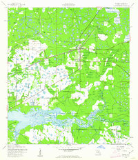
1944 Map of Parrish
USGS Topo · Published 1961About this map
The settlement of Parrish serves as the focal point of this wartime survey of northern Manatee County, centered around the junction of the Seaboard Air Line railroad. This landscape is defined by its complex hydrology, where the Manatee River winds along the southern edge, featuring landmarks like Fort Hamer and the sharp bend at Devils Elbow. The topography is dominated by extensive wetlands and hammocks, including Big Sawgrass and Branches Hammock, which illustrate the natural drainage patterns before modern intensive development. Numerous watercourses such as Gamble Creek and Mill Creek feed into the river system, while the presence of St Marys Ch and Flying Eagle Camp provides evidence of the established rural community and early recreational land use in the mid-1940s.
Find a feature on this map
19 named features on this map. Tap any name to fly to it.
Don’t see what you’re looking for? This feature index may not catch every label — zoom into the map to look around manually.
Map Details
Editions of this 1944 Parrish Map
2 editions found
Other maps of this area

1921 · Fort De Soto
USGS Topo · 1:62,500

1942 · Cockroach Bay
USGS Topo · 1:31,680

1944 · Ruskin
USGS Topo · 1:31,680

1944 · Rye
USGS Topo · 1:31,680

1944 · Wimauma
USGS Topo · 1:31,680

1944 · Verna
USGS Topo · 1:31,680

1944 · Lorraine
USGS Topo · 1:31,680

1944 · Ellenton
USGS Topo · 1:31,680

1944 · Parish
USGS Topo · 1:31,680

1945 · Cockroach Bay
USGS Topo · 1:31,680