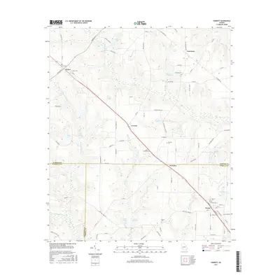
2017 Map of Parrott
USGS Topo · Published 2017About this map
Parrott anchors the southeastern corner of this landscape, where the local road network converges near the Parrott Cem. The terrain is defined by the winding course of the Ichawaynochaway Cr and its many tributaries, including Turkey Creek and Pine Head Creek, which feed into several named water bodies like Veneys Millpond and Davenports Millpond. These millponds suggest a history of water-powered industry that once shaped the local economy.
Find a feature on this map
92 named features on this map. Tap any name to fly to it.
Don’t see what you’re looking for? This feature index may not catch every label — zoom into the map to look around manually.
Map Details
Editions of this 2017 Parrott Map
This is the sole edition of this map. No revisions or reprints were ever made.
Other maps of this area

1953 · Dothan
USGS Topo · 1:250,000

1954 · Dothan
USGS Topo · 1:250,000

1955 · Dothan
USGS Topo · 1:250,000

1955 · Phenix City
USGS Topo · 1:250,000

1957 · Phenix City
USGS Topo · 1:250,000

1958 · Phenix City
USGS Topo · 1:250,000
1972 · Preston
USGS Topo · 1:24,000

1972 · Parrott
USGS Topo · 1:24,000
1972 · Richland
USGS Topo · 1:24,000
1972 · Benevolence
USGS Topo · 1:24,000