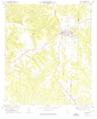
1972 Map of Richland
USGS Topo · Published 1974About this map
Richland serves as the central hub of this Georgia landscape, where the Seaboard Coast Line railroad creates a junction for local trade and transport. The map documents the community infrastructure of the early 1970s, including the County Jr High Sch, a Hospital, and Sewage Disposal Ponds at the town's eastern edge. Outside the main settlement, the area is defined by dispersed rural landmarks such as Upper Sardis Ch and Allen Chapel, along with smaller communities like Randall and Kimbrough.
Find a feature on this map
26 named features on this map. Tap any name to fly to it.
Don’t see what you’re looking for? This feature index may not catch every label — zoom into the map to look around manually.
Map Details
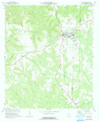
Editions of this 1972 Richland Map
2 editions found
Other maps of this area

1950 · Louvale
USGS Topo · 1:24,000

1950 · Lumpkin
USGS Topo · 1:24,000

1950 · Lumpkin
USGS Topo · 1:62,500

1953 · Dothan
USGS Topo · 1:250,000

1954 · Dothan
USGS Topo · 1:250,000

1955 · Dothan
USGS Topo · 1:250,000

1955 · Lumpkin
USGS Topo · 1:24,000
1955 · Louvale
USGS Topo · 1:24,000

1955 · Lumpkin
USGS Topo · 1:62,500

1955 · Phenix City
USGS Topo · 1:250,000