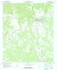
1972 Map of Richland
USGS Topo · Published 1991About this map
Richland serves as the focal point of this Stewart County landscape, where the Seaboard Coast Line Railroad forms a critical junction for the surrounding agricultural community. The town's layout is well-defined, featuring the County Jr High Sch, a Hospital, and several historic burying grounds such as Harmony Cem and Whitt Cem. To the west, the topography is carved by the winding paths of Hannahatchee Creek and Hodchodkee Creek, overlooked by the Stewart Lookout Tower. Small rural settlements and ecclesiastical sites dot the periphery, including Randall and Kimbrough, alongside the Upper Sardis Ch and Allen Chapel. This survey provides a clear look at the region’s mid-century rural infrastructure, from the industrial Sewage Disposal Ponds to the Pipeline corridors and various unnamed family cemeteries.
Find a feature on this map
27 named features on this map. Tap any name to fly to it.
Don’t see what you’re looking for? This feature index may not catch every label — zoom into the map to look around manually.
Map Details
Editions of this 1972 Richland Map
2 editions found
Other maps of this area

1950 · Louvale
USGS Topo · 1:24,000

1950 · Lumpkin
USGS Topo · 1:24,000

1950 · Lumpkin
USGS Topo · 1:62,500

1953 · Dothan
USGS Topo · 1:250,000

1954 · Dothan
USGS Topo · 1:250,000

1955 · Dothan
USGS Topo · 1:250,000

1955 · Lumpkin
USGS Topo · 1:24,000
1955 · Louvale
USGS Topo · 1:24,000

1955 · Lumpkin
USGS Topo · 1:62,500

1955 · Phenix City
USGS Topo · 1:250,000