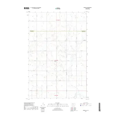
2018 Map of Parshall SE
USGS Topo · Published 2018About this map
The county line between Mountrail Co and McLean Co bisects this prairie landscape, where the rural grid is defined by early 21st-century roads such as 31st St NW and 71st Ave NW. This quadrangle illustrates a landscape of high-plains agriculture and scattered wetlands, anchored by two significant community sites. The Lucky Mound Lutheran Cem sits near the eastern boundary, while the Church of God Cem is located further south. The surveyor's grid, including t150n r89w, remains the dominant organizational structure for the farmsteads and access roads that crisscross the region, documenting the enduring footprint of North Dakota's homesteading history.
Find a feature on this map
19 named features on this map. Tap any name to fly to it.
Don’t see what you’re looking for? This feature index may not catch every label — zoom into the map to look around manually.
Map Details
Editions of this 2018 Parshall SE Map
This is the sole edition of this map. No revisions or reprints were ever made.
Other maps of this area

1953 · Watford City
USGS Topo · 1:250,000

1954 · McClusky
USGS Topo · 1:250,000

1956 · Makoti SW
USGS Topo · 1:24,000

1956 · Blackwater Lake NW
USGS Topo · 1:24,000

1957 · Watford City
USGS Topo · 1:250,000

1958 · McClusky
USGS Topo · 1:250,000

1967 · Watford City
USGS Topo · 1:250,000

1967 · Raub NW
USGS Topo · 1:24,000

1967 · Raub
USGS Topo · 1:24,000
1967 · Parshall SE
USGS Topo · 1:24,000