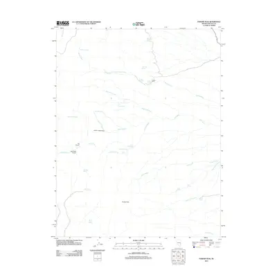
2012 Map of Parsnip Peak
USGS Topo · Published 2012About this map
Parsnip Peak anchors this high-desert landscape in Lincoln County, where the terrain is defined by the high elevations of the Wilson Creek Range and a complex network of seasonal washes and isolated water sources. The map reveals a high concentration of named springs, such as Throwout Knee Spring, Sage Hen Spring, and Board Cabin Spring, which indicate the critical importance of water management in this arid environment. These features, along with names like Buckhorn Ranch, point to a history of livestock grazing and land use that spans decades. The drainage patterns of Bowling Wash and Coyote Wash intersect with canyons like Tex Canyon and Red Cedar Canyon, creating a rugged topography where small-scale human improvements, often centered around these vital springs, are the primary markers of habitation.
Find a feature on this map
35 named features on this map. Tap any name to fly to it.
Don’t see what you’re looking for? This feature index may not catch every label — zoom into the map to look around manually.
Map Details
Editions of this 2012 Parsnip Peak Map
This is the sole edition of this map. No revisions or reprints were ever made.
Other maps of this area

1956 · Lund
USGS Topo · 1:250,000

1960 · Lund
USGS Topo · 1:250,000
1970 · Mt. Wilson SW
USGS Topo · 1:24,000
1970 · Mt. Wilson
USGS Topo · 1:24,000

1970 · Pierson Summit
USGS Topo · 1:24,000

1970 · Parsnip Peak
USGS Topo · 1:24,000

1972 · Buck Wash Well
USGS Topo · 1:24,000
1972 · Eagle Valley Reservoir
USGS Topo · 1:24,000

1972 · Miller Canyon
USGS Topo · 1:24,000

1973 · Schoolmarm Basin
USGS Topo · 1:24,000