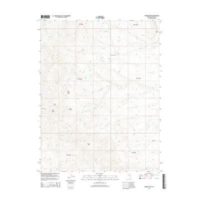
2014 Map of Parsnip Peak
USGS Topo · Published 2014About this map
Parsnip Peak stands as the central landmark in this high-desert landscape of eastern Nevada, where the drainage patterns of the Wilson Creek Range dictate the layout of the land. The area is defined by a complex network of ephemeral watercourses and vital spring points, such as Frenchman Spring and Sage Hen Spring, which have long served as essential resources in this arid environment. Ranching life is evident through access routes like Buckhorn Ranch Rd and Connors Ranch Rd, which navigate the terrain between deep incisions like Hulse Canyon and Tex Canyon. The map reveals how water travels across the desert floor via extensive systems like Bowling Wash and Parsnip Cr Wash, illustrating the geologic character of Lincoln County as it was documented in the early 21st century.
Find a feature on this map
45 named features on this map. Tap any name to fly to it.
Don’t see what you’re looking for? This feature index may not catch every label — zoom into the map to look around manually.
Map Details
Editions of this 2014 Parsnip Peak Map
This is the sole edition of this map. No revisions or reprints were ever made.
Other maps of this area

1956 · Lund
USGS Topo · 1:250,000

1960 · Lund
USGS Topo · 1:250,000
1970 · Mt. Wilson SW
USGS Topo · 1:24,000
1970 · Mt. Wilson
USGS Topo · 1:24,000

1970 · Pierson Summit
USGS Topo · 1:24,000

1970 · Parsnip Peak
USGS Topo · 1:24,000

1972 · Buck Wash Well
USGS Topo · 1:24,000
1972 · Eagle Valley Reservoir
USGS Topo · 1:24,000

1972 · Miller Canyon
USGS Topo · 1:24,000

1973 · Schoolmarm Basin
USGS Topo · 1:24,000