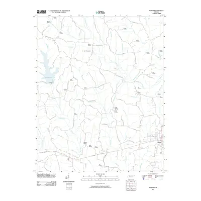
2010 Map of Parsons
USGS Topo · Published 2010About this map
The town of Parsons serves as the primary hub of this area, situated alongside the landing strip at Scott Field. The landscape is defined by an intricate network of waterways including Sulphur Fork Cub Creek and Johnson Creek, which feed into various man-made reservoirs like Dogwood Lake, regulated by the Dogwood Dam. The terrain is marked by family-named hollows such as Flowers Hollow and Duke Hollow, alongside numerous small cemeteries that reflect the deep-rooted local genealogy of the region.
Find a feature on this map
106 named features on this map. Tap any name to fly to it.
Don’t see what you’re looking for? This feature index may not catch every label — zoom into the map to look around manually.
Map Details
Editions of this 2010 Parsons Map
This is the sole edition of this map. No revisions or reprints were ever made.
Other maps of this area

1936 · Yuma
USGS Topo · 1:24,000

1936 · Scotts Hill
USGS Topo · 1:24,000

1936 · Parsons
USGS Topo · 1:24,000

1936 · Jeannette
USGS Topo · 1:24,000

1936 · Reagan
USGS Topo · 1:24,000

1936 · Sugar Tree
USGS Topo · 1:24,000

1936 · Cavvia
USGS Topo · 1:24,000

1936 · Perryville
USGS Topo · 1:24,000

1936 · Chesterfield
USGS Topo · 1:24,000

1949 · Perryville
USGS Topo · 1:24,000