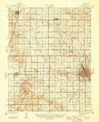
1947 Map of Parsons
USGS Topo · Published 1947About this map
The industrial and rail hub of Parsons anchors this mid-century survey, revealing a landscape defined by its complex transportation network. The town serves as a major junction for the Missouri Kansas Texas and St Louis San Francisco railroads, which crisscross the prairie to connect outlying settlements like Dennis and Galesburg. Beyond the urban grid of the city, which includes the State Asylum and Circle Park, the map documents a dense network of rural infrastructure that was soon to change.
Find a feature on this map
80 named features on this map. Tap any name to fly to it.
Don’t see what you’re looking for? This feature index may not catch every label — zoom into the map to look around manually.
Map Details
Editions of this 1947 Parsons Map
2 editions found

Other maps of this area

1886 · Fredonia
USGS Topo · 1:125,000

1886 · Iola
USGS Topo · 1:125,000

1886 · Independence
USGS Topo · 1:125,000

1886 · Parsons
USGS Topo · 1:125,000

1893 · Iola
USGS Topo · 1:125,000

1893 · Parsons
USGS Topo · 1:125,000

1894 · Fredonia
USGS Topo · 1:125,000

1894 · Independence
USGS Topo · 1:125,000

1904 · Iola
USGS Topo · 1:125,000

1905 · Independence
USGS Topo · 1:125,000