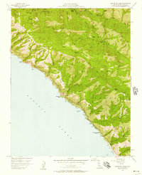
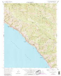
1956 Map of Partington Ridge
USGS Topo · Published 1957About this map
Andersen Landing and the surrounding coastal bluffs are documented here during the mid-1950s, a period when the Sea Otter Game Refuge protected the waters below the high ridges of the Los Padres National Forest. The landscape is defined by the steep transition from the Pacific Ocean to peaks like Andersen Peak and Mt Olmstead. Interior access is limited to the Coast Ridge Road and a network of remote sites along the Big Sur River, including Barlow Flat Camp, Sykes Camp, and Cienega Camp. The map provides a detailed view of the drainage systems of Partington Creek and Hot Springs Canyon before modern development altered the footprint of this shoreline. Notable landmarks such as McWay Falls, Grimes Point, and Timber Top mark the dramatic meeting of sea and mountain.
Find a feature on this map
45 named features on this map. Tap any name to fly to it.
Don’t see what you’re looking for? This feature index may not catch every label — zoom into the map to look around manually.
Map Details
Editions of this 1956 Partington Ridge Map
5 editions found
Other maps of this area

1918 · Point Sur
USGS Topo · 1:62,500

1920 · Jamesburg
USGS Topo · 1:48,000

1921 · Jamesburg
USGS Topo · 1:62,500

1921 · Lucia
USGS Topo · 1:62,500

1925 · Point Sur
USGS Topo · 1:62,500

1939 · Jamesburg
USGS Topo · 1:62,500

1940 · Jamesburg
USGS Topo · 1:62,500

1941 · Lucia
USGS Topo · 1:62,500

1947 · Lucia
USGS Topo · 1:62,500

1947 · Jamesburg
USGS Topo · 1:62,500