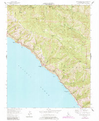
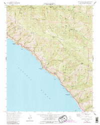
1956 Map of Partington Ridge
USGS Topo · Published 1984About this map
California State Highway 1 clings to the cliffs of the Big Sur coast, providing the primary arterial access between the shoreline and the steep interior of the Los Padres National Forest. This 1956 survey, updated with 1980s data, reveals a landscape defined by sharp elevation changes, where coastal landmarks like Partington Point and McWay Rocks sit at the base of ridges that rise rapidly to Anderson Peak and Marble Peak. The interior is accessible primarily via the Coast Ridge Road and the Pine Ridge Trail, connecting a series of remote camps such as Sykes Camp, Cold Spring Camp, and Cienega Camp. The map documents the defunct Anderson Landing on the Pacific edge, a site that once served as a maritime link for this isolated stretch of Monterey County before modern road engineering fully opened the region. Protected lands including Julia Pfeiffer Burns State Park and the Sea Otter Game Refuge underscore the area's conservation focus during the mid-20th century.
Find a feature on this map
57 named features on this map. Tap any name to fly to it.
Don’t see what you’re looking for? This feature index may not catch every label — zoom into the map to look around manually.
Map Details
Editions of this 1956 Partington Ridge Map
5 editions found
Other maps of this area

1918 · Point Sur
USGS Topo · 1:62,500

1920 · Jamesburg
USGS Topo · 1:48,000

1921 · Jamesburg
USGS Topo · 1:62,500

1921 · Lucia
USGS Topo · 1:62,500

1925 · Point Sur
USGS Topo · 1:62,500

1939 · Jamesburg
USGS Topo · 1:62,500

1940 · Jamesburg
USGS Topo · 1:62,500

1941 · Lucia
USGS Topo · 1:62,500

1947 · Lucia
USGS Topo · 1:62,500

1947 · Jamesburg
USGS Topo · 1:62,500