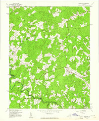
1942 Map of Partlow
USGS Topo · Published 1961About this map
Partlow and the surrounding woodlands of Spotsylvania County appear here during the early 1940s, revealing a rural landscape defined by small settlements and historic road crossings. The topography is intricately carved by several waterways, including the Mat River and the North River, which served as natural boundaries between neighboring counties. The settlement pattern is anchored by local landmarks such as Mount Pleasant and Gatewood, while the community’s social fabric is visible through New Hope Ch and Wallers Ch.
Find a feature on this map
16 named features on this map. Tap any name to fly to it.
Don’t see what you’re looking for? This feature index may not catch every label — zoom into the map to look around manually.
Map Details
Editions of this 1942 Partlow Map
2 editions found
Other maps of this area

1887 · Spottsylvania
USGS Topo · 1:125,000

1890 · Goochland
USGS Topo · 1:125,000

1892 · Spottsylvania
USGS Topo · 1:125,000

1892 · Goochland
USGS Topo · 1:125,000

1942 · Ladysmith
USGS Topo · 1:31,680

1942 · Partlow
USGS Topo · 1:31,680

1942 · Belmont
USGS Topo · 1:31,680

1942 · Contrary Creek
USGS Topo · 1:31,680

1942 · Spotsylania
USGS Topo · 1:31,680

1942 · Brokenburg
USGS Topo · 1:31,680