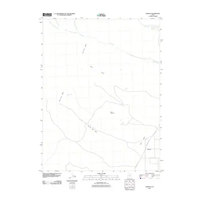
2011 Map of Partoun
USGS Topo · Published 2011About this map
Partoun sits within the high desert landscape of Snake Valley, where the alluvial plains meet the rising slopes of the Deep Creek Range. This 2011 survey captures the sparse settlement and infrastructure of western Juab County, centered around the intersection of the Pony Express Hwy and Snake Valley Rd. The map illustrates a reliance on precious water sources in an arid climate, marking numerous vital points such as Blue Spring, Trough Spring, and Lime Spring along the mountain flanks.
Find a feature on this map
18 named features on this map. Tap any name to fly to it.
Don’t see what you’re looking for? This feature index may not catch every label — zoom into the map to look around manually.
Map Details
Editions of this 2011 Partoun Map
This is the sole edition of this map. No revisions or reprints were ever made.
Other maps of this area

1908 · Fish Springs
USGS Topo · 1:250,000

1910 · Fish Springs
USGS Topo · 1:250,000

1953 · Delta
USGS Topo · 1:250,000

1956 · Ely
USGS Topo · 1:250,000

1958 · Delta
USGS Topo · 1:250,000

1959 · Ely
USGS Topo · 1:250,000

1961 · Trout Creek
USGS Topo · 1:62,500

1962 · Delta
USGS Topo · 1:250,000

1963 · Ely
USGS Topo · 1:250,000
1972 · Ibapah Peak
USGS Topo · 1:24,000