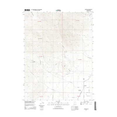
2014 Map of Partoun
USGS Topo · Published 2014About this map
Partoun sits at the edge of the Snake Valley in western Utah, where high desert basins meet the steep elevations of the Deep Creek Range. This 2014 survey documents a landscape defined by its water sources and rugged topography, featuring numerous named drainages such as Birch Cr, Wood Canyon, and the Little Red Cedar Wash. The terrain rises toward Lime Mtn and the larger range to the west, while the valley floor is crisscrossed by a network of local routes like S Snake Valley Rd and Gray Horse Rd.
Find a feature on this map
46 named features on this map. Tap any name to fly to it.
Don’t see what you’re looking for? This feature index may not catch every label — zoom into the map to look around manually.
Map Details
Editions of this 2014 Partoun Map
This is the sole edition of this map. No revisions or reprints were ever made.
Other maps of this area

1908 · Fish Springs
USGS Topo · 1:250,000

1910 · Fish Springs
USGS Topo · 1:250,000

1953 · Delta
USGS Topo · 1:250,000

1956 · Ely
USGS Topo · 1:250,000

1958 · Delta
USGS Topo · 1:250,000

1959 · Ely
USGS Topo · 1:250,000

1961 · Trout Creek
USGS Topo · 1:62,500

1962 · Delta
USGS Topo · 1:250,000

1963 · Ely
USGS Topo · 1:250,000
1972 · Ibapah Peak
USGS Topo · 1:24,000