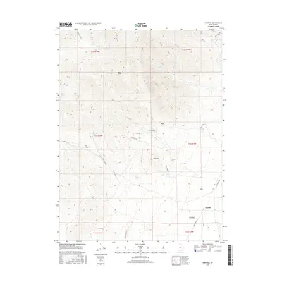
2017 Map of Partoun
USGS Topo · Published 2017About this map
Snake Valley and the high peaks of the Deep Creek Range dominate this desert landscape in western Juab County. The small settlement of Partoun sits on the valley floor, served by the Pony Express Hwy and local routes like Rawlings Blvd. The map reveals a complex system of canyon drainages and mountain springs, including Blue Spring and Trough Spring, which have long been vital water sources in this arid environment. Evidence of historical industry is found in the northeast corner at Trout Creek Mine 1. The terrain is marked by distinctive geological formations such as Red Ledge, Lime Mountain, and the intricate Crazy Horse Maze. A network of unpaved roads like Black Horse Road 7 and Little Canyon Right Fork suggests a landscape shaped by ranching and resource extraction, where the Birch Cr drainage carves through The Narrows.
Find a feature on this map
40 named features on this map. Tap any name to fly to it.
Don’t see what you’re looking for? This feature index may not catch every label — zoom into the map to look around manually.
Map Details
Editions of this 2017 Partoun Map
This is the sole edition of this map. No revisions or reprints were ever made.
Other maps of this area

1908 · Fish Springs
USGS Topo · 1:250,000

1910 · Fish Springs
USGS Topo · 1:250,000

1953 · Delta
USGS Topo · 1:250,000

1956 · Ely
USGS Topo · 1:250,000

1958 · Delta
USGS Topo · 1:250,000

1959 · Ely
USGS Topo · 1:250,000

1961 · Trout Creek
USGS Topo · 1:62,500

1962 · Delta
USGS Topo · 1:250,000

1963 · Ely
USGS Topo · 1:250,000
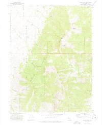
1972 · Ibapah Peak
USGS Topo · 1:24,000