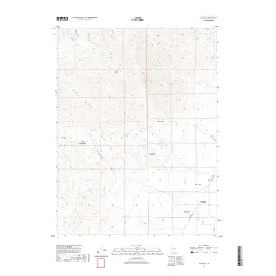
2020 Map of Partoun
USGS Topo · Published 2020About this map
Partoun is situated on the eastern edge of the Deep Creek Range where the mountains meet the expansive Snake Valley. This 2020 landscape is defined by its arid geography and historical transit routes, most notably the Pony Express Hwy which skirts the settlement. The topographic detail reveals a network of vital water sources in an otherwise dry environment, including Blue Spring, Lime Spring, and Trough Spring. The terrain transitions from the high elevations of Lime Mtn and The Narrows down through drainage systems like Little Red Cedar Wash and Wood Canyon. Local infrastructure is marked by thoroughfares such as Rawlings Blvd and Johnson Canyon Rd, illustrating the modern layout of this remote community near the Utah-Nevada border.
Find a feature on this map
25 named features on this map. Tap any name to fly to it.
Don’t see what you’re looking for? This feature index may not catch every label — zoom into the map to look around manually.
Map Details
Editions of this 2020 Partoun Map
This is the sole edition of this map. No revisions or reprints were ever made.
Other maps of this area

1908 · Fish Springs
USGS Topo · 1:250,000

1910 · Fish Springs
USGS Topo · 1:250,000

1953 · Delta
USGS Topo · 1:250,000

1956 · Ely
USGS Topo · 1:250,000

1958 · Delta
USGS Topo · 1:250,000

1959 · Ely
USGS Topo · 1:250,000

1961 · Trout Creek
USGS Topo · 1:62,500

1962 · Delta
USGS Topo · 1:250,000

1963 · Ely
USGS Topo · 1:250,000
1972 · Ibapah Peak
USGS Topo · 1:24,000