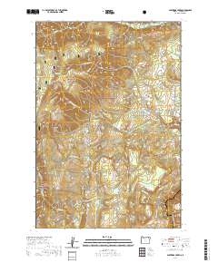
2020 Map of Partridge Creek
USGS Topo · Published 2020About this map
Umatilla National Forest dominates this section of the Blue Mountains, where a complex network of forest service roads and natural drainages defines the Union County landscape. The Grande Ronde River cuts across the southeastern corner, serving as the primary hydraulic anchor for the numerous creeks that dissect these uplands, including Eagle Cr, Lookingglass Cr, and the namesake Partridge Cr. High-elevation clearings like Galloway Meadows provide breaks in the timber, while reliable water sources such as Alpine Spring, Waight Spring, and Daws Spring have long supported both wildlife and seasonal grazing operations. The transition from the steep walls of Moon Canyon to the more accessible routes like Palmer Junction Rd and Keen-Cabin Creek Rd illustrates the historical reliance on these narrow corridors for timber management and access to the rugged interior of Northeast Oregon.
Find a feature on this map
34 named features on this map. Tap any name to fly to it.
Don’t see what you’re looking for? This feature index may not catch every label — zoom into the map to look around manually.
Map Details
Editions of this 2020 Partridge Creek Map
This is the sole edition of this map. No revisions or reprints were ever made.
Other maps of this area

1953 · Pendleton
USGS Topo · 1:250,000

1955 · Grangeville
USGS Topo · 1:250,000

1956 · Pendleton
USGS Topo · 1:250,000

1959 · Grangeville
USGS Topo · 1:250,000

1963 · Andies Prairie
USGS Topo · 1:24,000

1963 · Sanderson Spring
USGS Topo · 1:24,000

1963 · Tollgate
USGS Topo · 1:24,000

1964 · Partridge Creek
USGS Topo · 1:24,000

1964 · Cricket Flat
USGS Topo · 1:24,000

1964 · Elgin
USGS Topo · 1:24,000