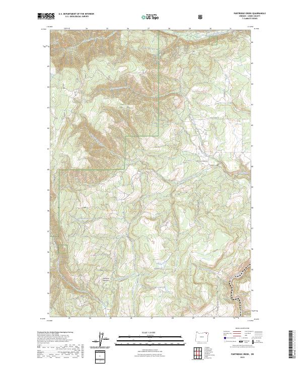
2023 Map of Partridge Creek
USGS Topo · Published 2023About this map
Umatilla National Forest encompasses the majority of this landscape in northeastern Oregon, where a dense network of water sources feeds the larger regional drainage system. The topography is defined by the descent toward the Grande Ronde River, which cuts through the southeastern corner of the quadrangle. High-altitude water points such as Alpine Spring, Lady Spring, and Waight Spring indicate the hydrologic importance of these uplands.
Find a feature on this map
32 named features on this map. Tap any name to fly to it.
Don’t see what you’re looking for? This feature index may not catch every label — zoom into the map to look around manually.
Map Details
Editions of this 2023 Partridge Creek Map
This is the sole edition of this map. No revisions or reprints were ever made.
Other maps of this area

1953 · Pendleton
USGS Topo · 1:250,000

1955 · Grangeville
USGS Topo · 1:250,000

1956 · Pendleton
USGS Topo · 1:250,000

1959 · Grangeville
USGS Topo · 1:250,000

1963 · Andies Prairie
USGS Topo · 1:24,000

1963 · Sanderson Spring
USGS Topo · 1:24,000

1963 · Tollgate
USGS Topo · 1:24,000

1964 · Partridge Creek
USGS Topo · 1:24,000

1964 · Cricket Flat
USGS Topo · 1:24,000

1964 · Elgin
USGS Topo · 1:24,000