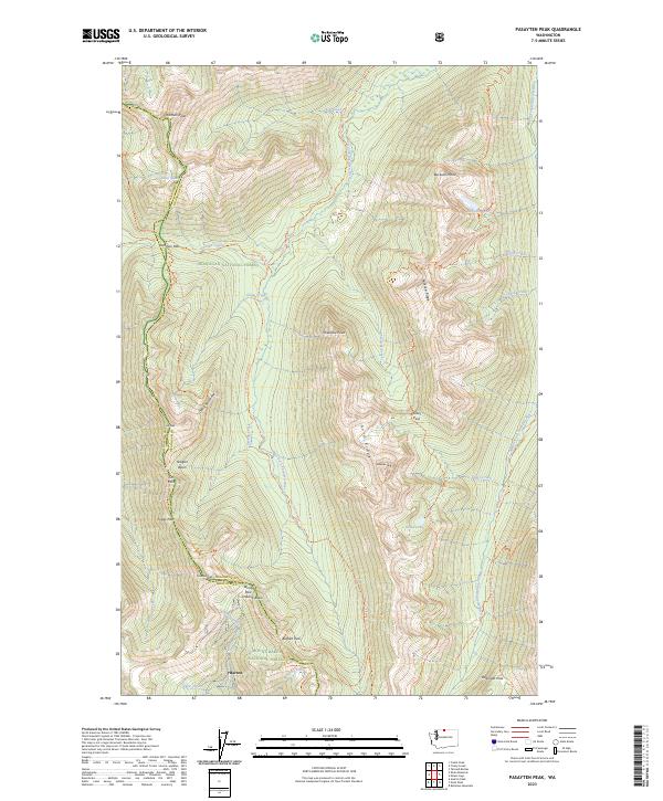
2023 Map of Pasayten Peak
USGS Topo · Published 2023About this map
Barron stands as the lone named settlement in this high-altitude landscape where the Pasayten Wilderness meets the Okanogan National Forest. The terrain is defined by a succession of prominent summits including Holman Peak, Jim Peak, and Pasayten Peak, connected by a network of high-elevation crossings like Holman Pass and Jim Pass. The headwaters of the West Fork Pasayten River and Middle Fork Pasayten River carve deep valleys between massive formations like Buckskin Ridge and Gold Ridge. The mapping detail emphasizes pedestrian transit over motorized travel, tracing the iconic Pacific Crest National Scenic Trl as it winds along the Devils Backbone and through Foggy Pass. This 2023 survey illustrates the continued preservation of the upper North Cascades, where glacial basins like Indiana Basin and Oregon Basin remain largely untouched by modern development.
Find a feature on this map
54 named features on this map. Tap any name to fly to it.
Don’t see what you’re looking for? This feature index may not catch every label — zoom into the map to look around manually.
Map Details
Editions of this 2023 Pasayten Peak Map
This is the sole edition of this map. No revisions or reprints were ever made.
Other maps of this area

1920 · Slate Pass
USGS Topo · 1:125,000

1955 · Concrete
USGS Topo · 1:250,000

1958 · Concrete
USGS Topo · 1:250,000

1962 · Concrete
USGS Topo · 1:250,000

1963 · Azurite Peak
USGS Topo · 1:24,000

1963 · Slate Peak
USGS Topo · 1:24,000
1963 · Robinson Mtn.
USGS Topo · 1:24,000

1969 · Frosty Creek
USGS Topo · 1:24,000
1969 · Pasayten Peak
USGS Topo · 1:24,000

1969 · Tatoosh Buttes
USGS Topo · 1:24,000