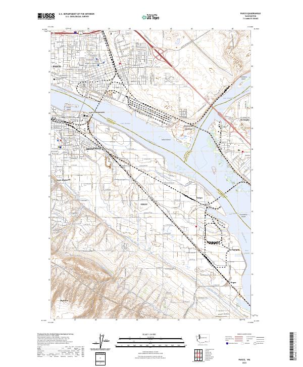
2023 Map of Pasco
USGS Topo · Published 2023About this map
Pasco and Kennewick sit at a vital hydrographic crossroads where the Columbia River widens into Lake Wallula. This modern survey illustrates the complex irrigation and transport infrastructure of the Tri-Cities area, including the Columbia Canal Number 1 and Highlift Canal. The landscape is shaped by industrial and civic hubs like the Port of Kennewick and the Franklin County Courthouse, alongside preserved natural areas such as the McNary National Wildlife Refuge. Moving south from the urban centers, the map details the agricultural and riverside developments at Finley and Hedges, where the BNSF Railway parallels the riverbanks. Local history is anchored by the City View Cem and landmarks like Clover Island, while the Columbia Plateau State Park Trail traces the region's geographic heritage.
Find a feature on this map
44 named features on this map. Tap any name to fly to it.
Don’t see what you’re looking for? This feature index may not catch every label — zoom into the map to look around manually.
Map Details
Editions of this 2023 Pasco Map
This is the sole edition of this map. No revisions or reprints were ever made.
Other maps of this area

1915 · Wallulah
USGS Topo · 1:96,000

1917 · Pasco
USGS Topo · 1:125,000

1918 · Wallula
USGS Topo · 1:125,000

1953 · Walla Walla
USGS Topo · 1:250,000

1958 · Walla Walla
USGS Topo · 1:250,000

1964 · Wallula
USGS Topo · 1:24,000

1964 · Levey SW
USGS Topo · 1:24,000

1964 · Humorist
USGS Topo · 1:24,000
1964 · Johnson Butte
USGS Topo · 1:24,000
1964 · Nine Canyon
USGS Topo · 1:24,000