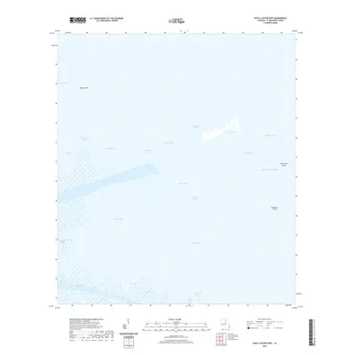
2020 Map of Pass a Loutre East
USGS Topo · Published 2020About this map
The Pass a Loutre waterway system dominates this aquatic landscape in Plaquemines Parish, where the Mississippi River delta meets the Gulf of Mexico. This survey illustrates the intricate network of distributaries and bays that characterize the outer reaches of the Birdfoot Delta. Notable coastal features like Lighthouse Bayou and Customhouse Bay point to a history of maritime navigation and customs enforcement at this critical river mouth. The terrain is defined by shifting sediments, evidenced by unique geological formations such as the North Mud Lumps and Thomasin Lumps. Navigation channels like North Pass, Southeast Pass, and Northeast Pass slice through the wetlands, creating a complex patchwork of marsh and open water. Between these active passes lie shallow basins such as Blind Bay and Bull Bay, demonstrating the active deltaic processes of land loss and accretion that continue to reshape the Louisiana coastline.
Find a feature on this map
24 named features on this map. Tap any name to fly to it.
Don’t see what you’re looking for? This feature index may not catch every label — zoom into the map to look around manually.
Map Details
Editions of this 2020 Pass a Loutre East Map
This is the sole edition of this map. No revisions or reprints were ever made.
Other maps of this area

1893 · East Delta
USGS Topo · 1:62,500

1935 · Garden Island Pass
USGS Topo · 1:31,680

1935 · South Pass
USGS Topo · 1:31,680

1947 · Garden Island Pass
USGS Topo · 1:31,680

1947 · Pass A Loutre West
USGS Topo · 1:31,680

1947 · Main Pass
USGS Topo · 1:31,680

1947 · Pass A Loutre East
USGS Topo · 1:31,680

1953 · Breton Island
USGS Topo · 1:62,500
1954 · Pass A Loutre East
USGS Topo · 1:31,680
1954 · Pass A Loutre West
USGS Topo · 1:31,680