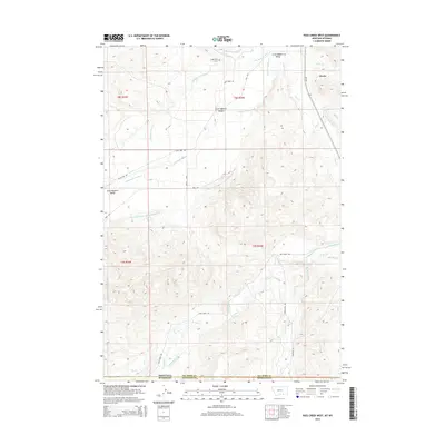
2014 Map of Pass Creek West
USGS Topo · Published 2014About this map
Little Bighorn Valley and the settlement of Wyola anchor this Montana-Wyoming borderland survey, illustrating a landscape defined by an intricate network of early 21st-century irrigation infrastructure. The terrain is marked by numerous engineered waterways, including the Bozeman Trail Ditch, Campbell Belken Ditch, and the lengthy Upper Little Bighorn Canal Number Two. These features, alongside Woodley Ditch and Thompson Ditch, demonstrate the critical role of water management in supporting the agricultural life of the high plains. Natural drainage is provided by the Little Bighorn River and various tributaries such as Crazy Cr and Wyola Cr. Local history is centered on the small community of Wyola and the Brightwing Cem, while the state line divides the landscape between the Big Horn Co and Sheridan Co districts.
Find a feature on this map
30 named features on this map. Tap any name to fly to it.
Don’t see what you’re looking for? This feature index may not catch every label — zoom into the map to look around manually.
Map Details
Editions of this 2014 Pass Creek West Map
This is the sole edition of this map. No revisions or reprints were ever made.
Other maps of this area

1894 · Rosebud
USGS Topo · 1:125,000

1894 · St. Xavier
USGS Topo · 1:125,000

1895 · Dayton
USGS Topo · 1:125,000

1898 · Bald Mountain
USGS Topo · 1:125,000

1901 · Rosebud
USGS Topo · 1:125,000

1901 · Dayton
USGS Topo · 1:125,000

1901 · St. Xavier
USGS Topo · 1:125,000

1901 · Bald Mountain
USGS Topo · 1:125,000

1954 · Hardin
USGS Topo · 1:250,000

1955 · Sheridan
USGS Topo · 1:250,000